
Delving into the property market of Huntingdon and the broader scope of Huntingdonshire can be a complex affair without the sharp insights provided by Homesurv’s expert surveyors. With extensive local knowledge and over 25 years of experience, Homesurv stands as a beacon of expertise in the region. This guide underpins the critical role played by Homesurv’s professionals in property surveying and how their services enrich property transactions and management across Huntingdonshire.
Homesurv: Synonymous with Expert Surveying in Huntingdon and Huntingdonshire
Homesurv has etched its name as the local authority on property surveying within the charming environs of Huntingdon and the picturesque landscapes of Huntingdonshire. Catering to a variety of properties, Homesurv’s chartered surveyors discern the quintessential elements that define the region’s architecture and market values, embodying the pivotal role of precise and considerate surveying in the county’s property dynamics.
2. Homesurv’s Proficiency: Building Surveyors and Property Surveyors Defined
Building Surveyors Huntingdon by Homesurv
Homesurv’s building surveyors excel in delineating the condition of buildings in Huntingdon, with a sharp focus on both historical constructions and modern dwellings. Homesurv’s detailed reports encapsulate critical data on repairs and maintenance, fortified by their chartered status and in-depth understanding of local building legislation and heritage conservation.
Property Surveyors Huntingdon by Homesurv
The property surveyors at Homesurv navigate the nuances of property valuation, ensuring that each transaction reflects the true potential and value of assets in Huntingdonshire. They operate with the precision that comes from a quarter-century of valuating a range of property types, backed by current market analytics and bespoke advisory.
3. Why Homesurv’s Local Acumen in Huntingdonshire is Invaluable
Unmatched Local Expertise
The Homesurv team’s roots in Huntingdonshire empower them to conduct assessments with an unmatched depth of local knowledge. This profound insight secures a competitive edge for clients, grounding each service—from valuations to surveys—in a rich understanding of local zoning laws, development plans, and environmental factors.
Adaptable Services for All Properties
With the capacity to adapt to any surveying requirement, Homesurv covers all bases, from structural examinations for conservation properties to residential evaluations for newer estates. They champion a versatile approach, ensuring that every property’s unique characteristics are thoroughly considered and evaluated.
Specialist Problem Resolution
Homesurv’s surveyors bring focused problem-solving skills to the forefront, especially in addressing the specific concerns of Huntingdonshire’s geography and infrastructure. Their proactive approach is essential for detailed assessments, from the flood risks of the Great Ouse area to the special conditions of rural and suburban developments.
In encapsulating the value of a professional local surveyor, Homesurv’s team in Huntingdonshire represents an unparalleled resource. The fusion of their surveying expertise and local understanding not only provides reassurance but also instils a layer of foresight into property investments. The result is a spectrum of services that not only diagnose and advise but also strategise and safeguard the interests of property stakeholders across Huntingdon and the surrounding county.
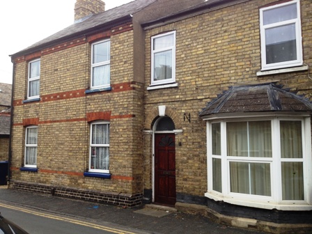
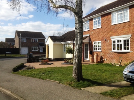
Huntingdon
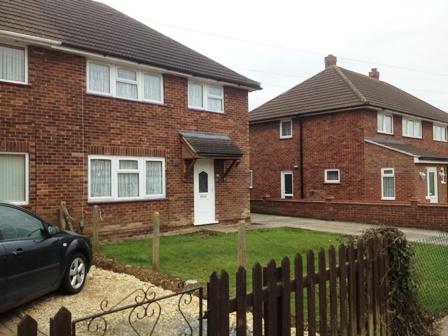
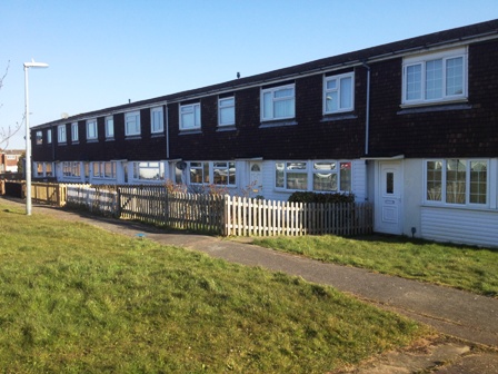
1990’s terrace housing
Stukeley Meadows
Hinchingbrooke
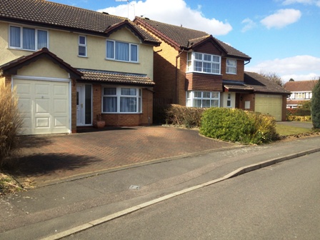
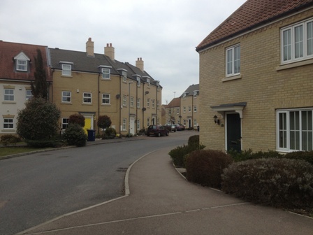
Huntingdon is located north of the River Ouse. The central parts comprise housing built around the 1900s. The town grew slowly until the 1960’s when it expanded to the northwest with private houses and bungalows and to the north with Local Authority built houses. Further expansion occurred in the 1980s and 1990s with the development of housing around Hartford which was originally a separate village and an area to the northwest called Stukeley Meadows. This area is next to the busy A14 and can be affected by road noise. The most recent housing development is the former Alconbury airbase known as Alconbury Weald.
The vast majority of housing in Huntingdon comprises traditional construction i.e. brick walls beneath a pitched slate or tile roof. However, after the Second World War, there was a shortage of certain types of building materials and a significant demand for housing. The solution was to construct houses using some non-traditional materials. An example of this is some houses around American Lane that make use of steel instead of wood for the roof structure.
American Lane
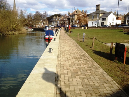
St Ives
St Ives is built on the banks of the wide Great Ouse river and is located between Huntingdon and Ely. During the 18th and 19th centuries, St Ives was a hub of trade and navigation and most of the housing in and around the town centre dates from this period. Further housing development took place in the 1930s when the Local Authority built a number of houses in the High Leys area. However, the most significant expansion of the town took place in the 1970s and 1980s when a large, mainly private, housing development was constructed to the north of the A1123. The most recent development is taking place to the west of the town part of which is on the old St Ives golf club site.

The Leys
Typical 1980s Housing
The Great Ouse river at St Ive’s flooded in 1947 and some parts suffered seriously again at Easter 1998 and in January 2003. Extensive flood protection works were carried out on both sides of the river in 2006/2007 at a cost of nearly £9 million.
St Ives is a popular residential location due to its local shopping amenities and its close proximity to Cambridge. House prices tend to be slightly higher than Huntingdon due to its closer proximity to Cambridge which is only 20 minutes away by car.
Flood protection scheme
St Neots
St Neots lies close to the south-western boundary of Huntingdonshire District, in the valley of the Great Ouse river. It is partly on the flood plain and partly on slightly higher ground. Today, St Neots is a thriving dormitory, commuter and market town. The modern town incorporates Eynesbury (originally the main settlement and the oldest part of the town) and two areas across the river, Eaton Ford and Eaton Socon, which were original, separate villages. Until recently the whole of St Neots lay between the A1 on the west and the main London to Peterborough rail line to the east. However, a recent large development to the east of the rail line called Love’s Farm has expanded the town beyond these limits.

Eynesbury
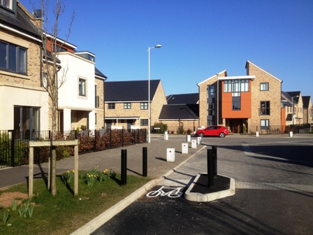
Love’s Farm
Houses in the town centre can date back to the 18th century. However, the majority of development has taken place post-1970. Most houses are of traditional masonry construction being of brick walls beneath a pitched tile or slate roof. A number of houses built by the local authority are of either timber frame construction or a mixture of timber frame and traditional masonry called Cross Wall. There is an increasing number of privately built properties constructed of timber frame with a brick or render outside skin.
LA timber frame
There are no common geological or mining issues in St Neots but a number of properties are affected by either rail or road noise.
Homesurv Ltd’s Coverage Of HUNTINGDONSHIRE
Homesurv has undertaken Homebuyer Reports and Building Surveys in Huntingdonshire for over 15 years. We cover post codes are:-
- PE7 – Yaxley, Whittlesey and Stilton
- PE26 – Ramsey
- PE28 – Sawtry, Alconbury, Bramton, Warboys, the Hemingfords and Kimbolton
- PE19 – St Neots, Little Paxton and Buckden
- PE27 St Ives and Needingworth